🌐
Multi-source fusion
adsb.fi, adsb.lol, airplanes.live and OpenSky plus a satellite-ADS-B merge, de-duplicated by ICAO 24-bit address — one airframe, not three dots. How fusion works →
60+ FEEDS🎯
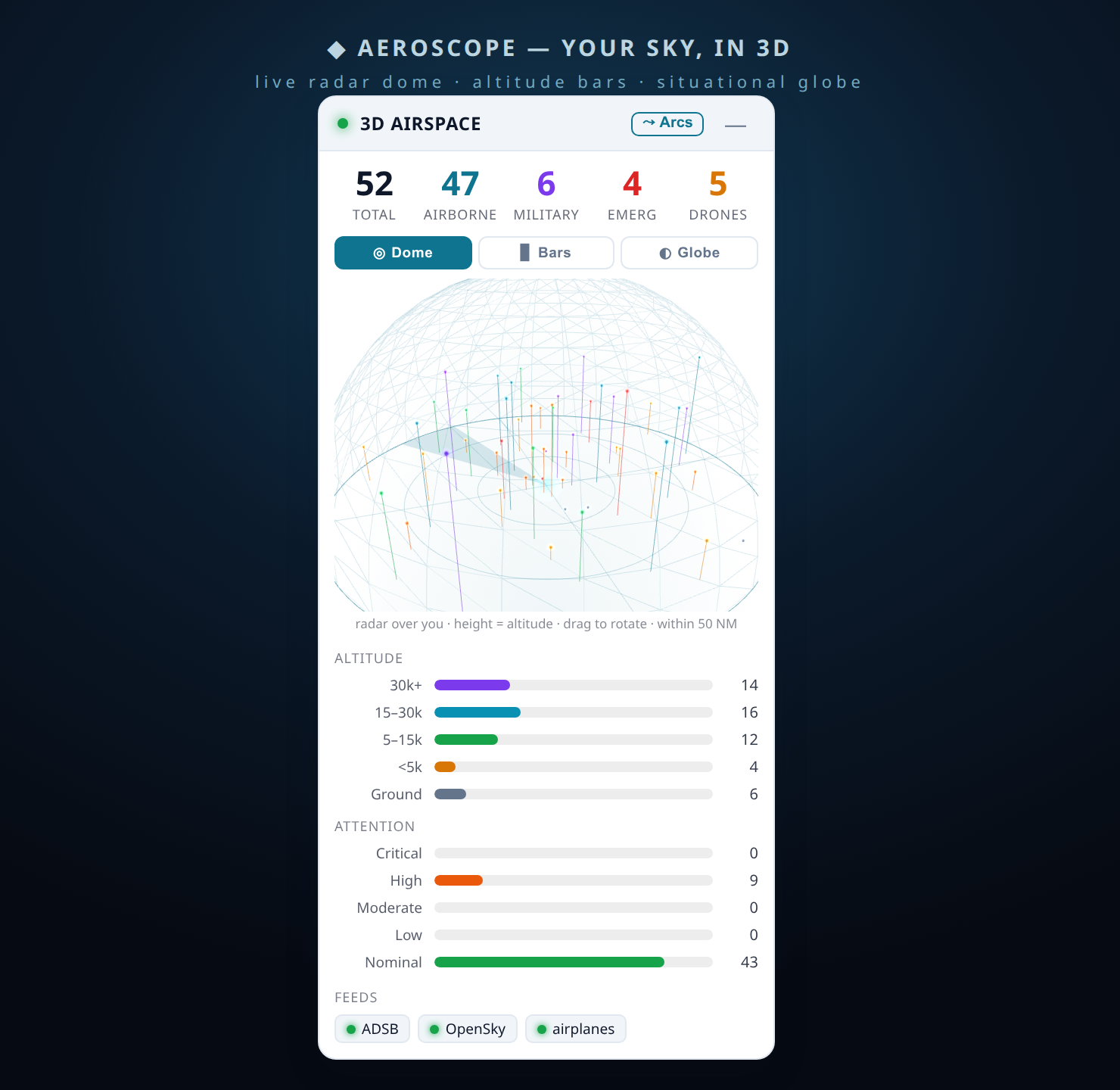
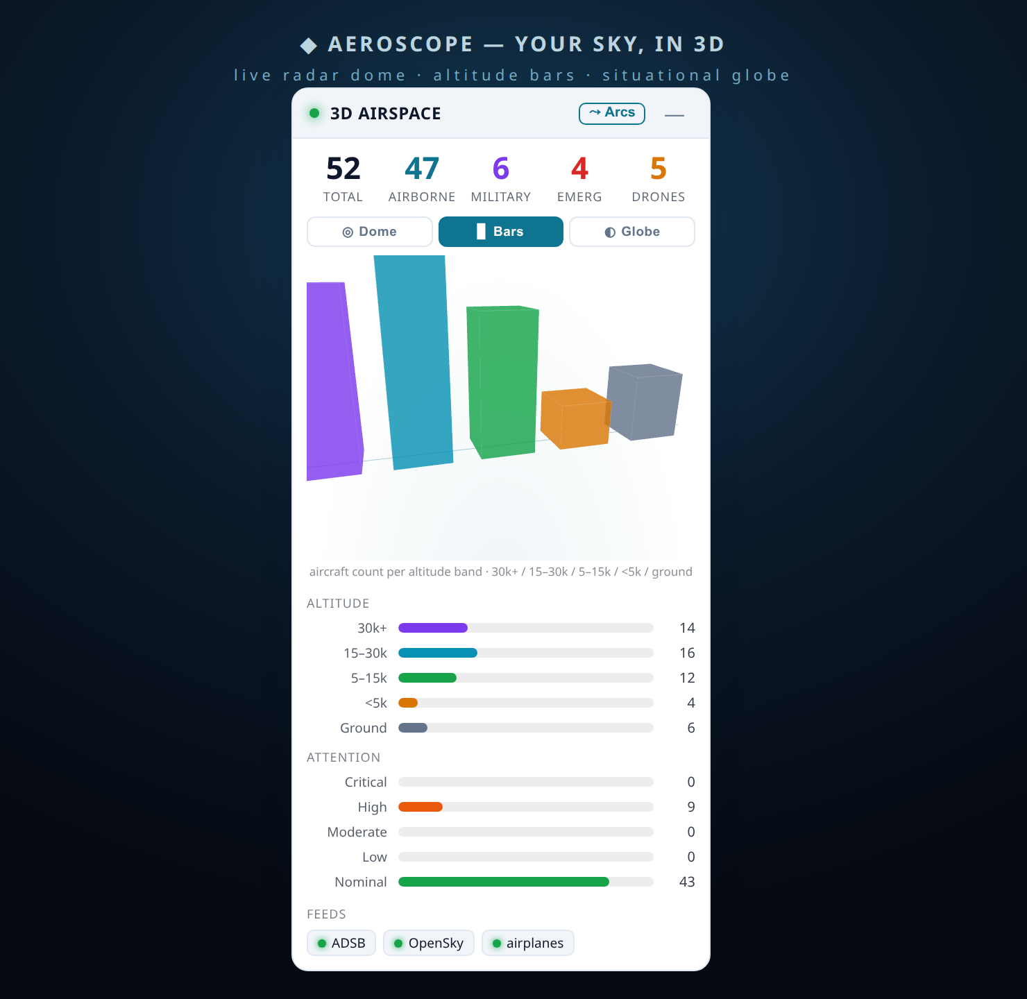
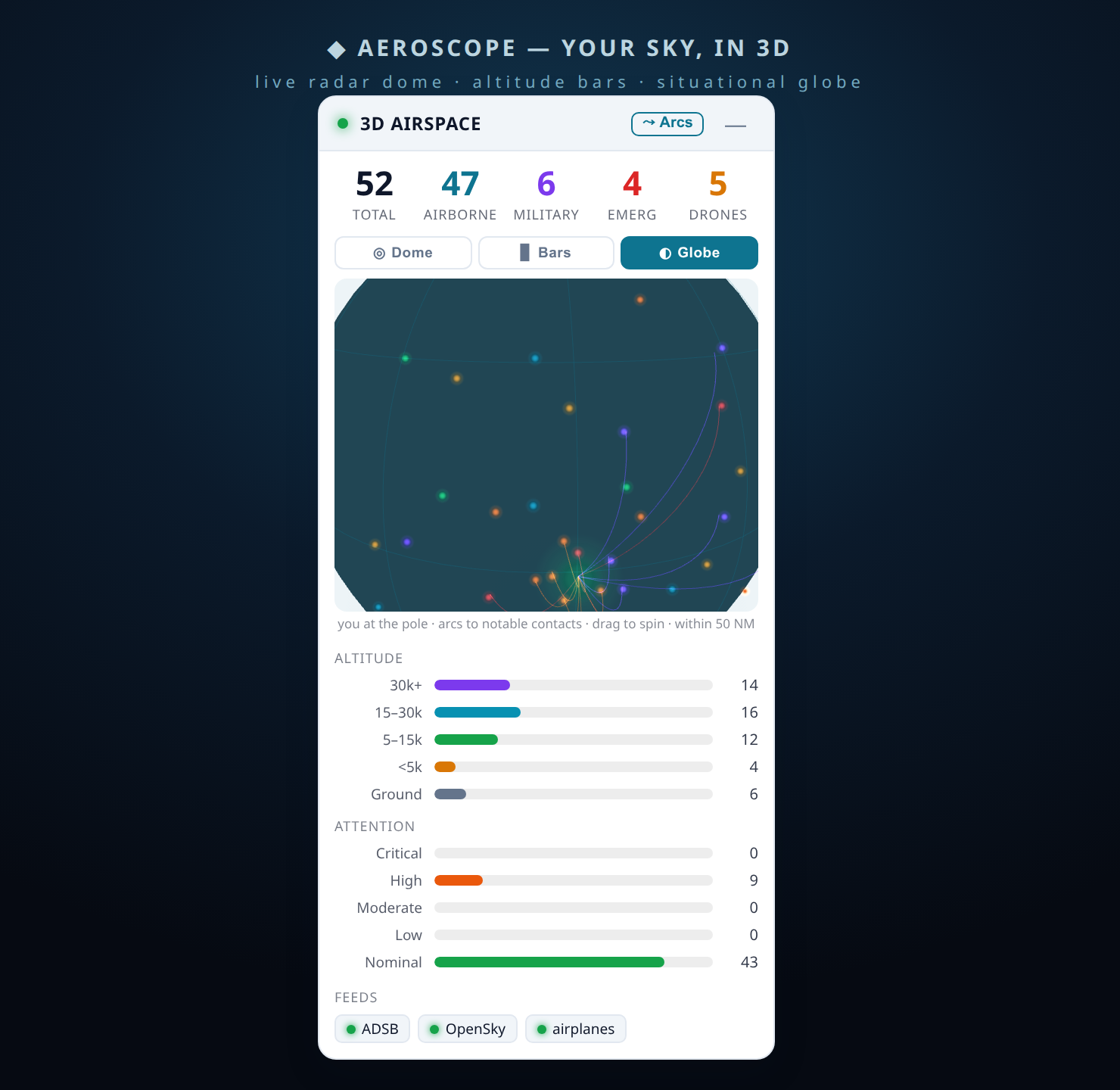
Attention scoring
Eight weighted rule-based factors summed into an explainable 0–100 rank. Always shows its working; never an accusation. See the score →
8 FACTORS🧠
Consensus anomaly detection
River, scikit-learn IsolationForest, a pykalman innovation test, OpenAP envelope checks, stumpy matrix profiles and PyOD — a flag fires only on ≥2-detector agreement. Detectors →
TORCH-FREE🛡️
Spoofing & integrity
A DO-260B-style 7-check plus a Kalman normalised-innovation test and altitude/speed/heading residuals expose self-inconsistent messages. Integrity →
DO-260B🛸
Drone / UAV heuristics
Remote-ID parsing plus behavioural signatures — low-and-slow, tight loiters — surface candidate uncrewed aircraft. Drone detection →
REMOTE-ID🛰️
Real-time smooth map
Client-side dead-reckoning glides every aircraft at its true ground speed between fixes and corrects toward truth without snapping back. The pipeline →
DEAD-RECKONING🧭
Pattern-of-life
Automatic orbit, racetrack, loiter and grid-search classification with per-airframe behavioural baselines for deviation scoring. Baselines →
BEHAVIOURAL🚧
Geofencing & alerts
Circle and polygon zones with enter/exit events, emergency-squawk detection (7500/7600/7700) and observer-relative proximity thresholds. Geofence guide →
OBSERVER-RELATIVE📦
Open data & API
CSV, JSON and GeoJSON exports plus a documented REST/WebSocket API — reproducible analysis, not a black box. API docs →
CSV / JSON / GEOJSON